Gopher Loop
-
Rating: Long
-
Distance: 16.3-mile loop
-
Elevation
-
Trailhead: 7,840 feet
-
Max: 8150 feet
-
Min: 7600 feet
-
Gain: 1200 feet
-
-
Trailhead Directions: Turkey Springs Trail (#301), 9.1 miles northwest of Pagosa Springs)
-
Road Status: Piedra Road (CR600) - open year-round
-
Notes: Non-technical, rolling forested terrain
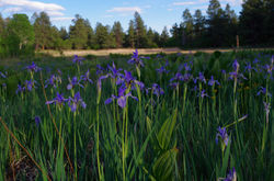
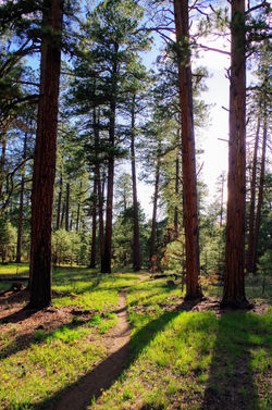
 Gopher Trail |  Wild Iris |
|---|---|
 Mule's Ear |  Wild Iris |
 Glacier Lily |  Gopher Trail |
 Turkey Springs Trail |  Gopher Trail |
 Gopher Trail |  Gopher Trail |
 Catamount Trail |
Located 9.1 miles northwest of Pagosa Springs, the Turkey Springs Trail begins as multi-use, double track trail that is shared with ATVs. At mile 0.4, the single track trail diverges to the left (look for the Turkey Springs Trail sign). The trail is rocky in spots as it climbs steadily to the junction with the Catamount trail at mile 1.
To do the loop clockwise, take a left (south) at the Catamount trail sign. Catamount trail will wind through the pine and then descend a few rocky outcrops, cross an intermittent stream, and contour to a junction with Park Avenue Trail at mile 2.9. Take a left (east) and continue on this fast section of Catamount.
At mile 4.3, you'll reach Newt Jack Trail near a fenceline. Cross the blue cattleguard through the fence (Newt Jack Trail and Catamount Trail merge during this short, rocky section). Catamount trail veers to the right after the rocky section (it's easy to miss). You'll immediately pass a stock pond, and enjoy the smooth, 1-mile, downhill section of Catamount (one of my favorites). During the downhill, stay right as you pass Bear Trail and Creek Trail.
The downhill section ends at a rocky, seasonal creek crossing, and then you climb a few hundred feet to the junction with Round Park trail at mile 5.4. Take a hard right onto Round Park Trail and begin climbing steadily toward the Round Park Stock Pond (mile 6). After passing through the Round Park meadow, you'll climb to the Aspen Run trail junction (mile 6.3). Take a left on Aspen Run.
After about a mile of climbing, Aspen Run crosses Brockover Trail (an old road) at mile 7.2 and then begins a great downhill section through an aspen-lined canyon. Aspen Run Ts at Gopher Trail next to a giant ponderosa pine at mile 8.6. Take a right on Gopher Trail and traverse the green meadow, which is filled with gopher holes and lined by cottonwood and large aspen. At the end of the meadow, the trail gains 500 vertical feet over the next 2-miles as it heads north to Brockover Mesa.
After some much-earned downhill, the trail crosses a cattle guard and then Brockover Road at mile 11.3 and passes by the Gopher Trailhead. Continue on Gopher and you'll pass the Round Park Trail a quarter mile later. Gopher Trail contours through a recent prescribed burn and Ts with Turkey Springs Trail at mile 12.8. Take a right and head northeast on Turkey Springs Trail. You'll pass the junction with Park Avenue Trail at mile 13.3 at the edge of a large meadow. Continue on Turkey Springs Trail as is ascends the final climb of the ride. After a fast descent, cross through a fence via a cattle guard and then pass by the Newt Jack Trailhead and then cross Newt Jack Road at mile 14.9 and make your final descent back to the trailhead.