Round Park Loop
-
Rating: Moderate
-
Distance: 13.5-mile loop
-
Elevation
-
Trailhead: 7,840 feet
-
Max: 8140 feet
-
Min: 7590 feet
-
Gain: 980 feet
-
-
Trailhead Directions: Turkey Springs Trail (#301), 9.1 miles northwest of Pagosa Springs)
-
Road Status: Piedra Road (CR600) - open year-round
-
Notes: Non-technical, rolling forested terrain
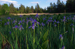
 Wild Iris line Round Park |  Round Park |
|---|---|
 Turkey Springs Trail |  Turkey Springs Trail |
 Turkey Springs Trail |  Turkey Springs Trail |
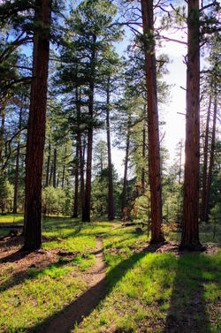
 Gopher Trail |  Gopher Trail |
 Catamount Trail |  Glacier lily |
 Wild Iris |  Mule's Ear |
The Turkey Springs Trail begins as multi-use, double track trail that is shared with ATVs. At mile 0.4, the single track trail diverges to the left (look for the Turkey Springs Trail sign). The trail is rocky in spots as it climbs steadily to the junction with the Catamount trail at mile 1.
To do the loop counter-clockwise, continue past the Catamount trail sign and cross Newt Jack Road at mile 1.3. Cross a narrow meadow and then cross a cattle guard at mile 1.9. Continue straight (left is an abandoned trail, and right is a spur trail to Turkey Springs Road). Climb to the highest point and then drop down to the Park Avenue Junction at mile 2.9. At the junction, continue straight on Turkey Springs Trail to the Gopher Trail at mile 3.4. Take a left on Gopher Trail (going straight will take you to Turkey Springs Road). Gopher Trail is smooth and flowy and winds through stands of large ponderosa pine. At mile 4.7, take a left on Round Park Trail and trend southeast until reach a trail junction with Aspen Run at mile 7. Continue on Round Park Trail and descend to Round Park (a small, green meadow with a stock pond) at mile 7.3. Climb out of Round Park and descend to the lowest point of the route, near the junction with Catamount Trail at mile 7.9. Take a left on Catamount Trail, cross an intermittent stream and begin a gradual climb inside a cool, shallow canyon lined with aspen. Continue straight when you pass by Creek Trail and you'll shortly pass by a small, salamander-filled stock pond. Veer left when you pass by the Bear Trail at mile 8.6 and take a left on Catamount at the stock pond located at Lower Newt Jack Road at mile 8.9. Cross over a small cattle guard and cross the faint Lower Newt Jack Road and continue northwest on Catamount Trail. At mile 9.3, veer left on Catamount instead of straight (straight is a spur trail that takes you to North Pagosa Blvd). Continue ascending Catamount till you reach a junction with the Park Avenue Trail at mile 10.4. Take a right on Catamount and climb to the junction with Turkey Springs Trail at mile 12.3. Ignore the several unsigned trails thought this section that veer off to the right...these are unofficial trails that end up in the Hatcher area. Take a right on Turkey Springs Trail and enjoy a steep, fast descent back to the parking area.
To shorten the loop by 2 miles and avoid the uphill start, start at the Newt Jack Trailhead. Just past the main trailhead on Piedra Road, take a left onto take Turkey Springs Road (FR629, on the left just beyond the main trailhead) to Newt Jack Road (FR923) and you'll find another trailhead about a tenth of a mile down Newt Jack Road.