Coyote Hill (San Juan National Forest)
-
Rating: Easy with one moderate section
-
Distance: 3.4-mile loop
-
Elevation
-
Trailhead: 7,840 feet
-
Max: 8120 feet
-
Min: 7840 feet
-
Gain: 380 feet
-
-
Trailhead Directions: Coyote Hill Loop (314), 9.1 miles northwest of Pagosa Springs
-
Road Status: Piedra Road (CR600) is open year-round
-
Hike or Bike or Nordic Ski. Great hiking spot for kids.
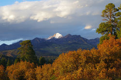
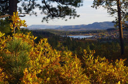
 Coyote Hill near Pagosa Springs |  Coyote Hill near Pagosa Springs |
|---|---|
 Coyote Hill near Pagosa Springs |  Coyote Hill near Pagosa Springs |
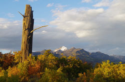
 Fall Dusting on Pagosa Peak |  Lake Hatcher from Coyote Hill |
 Eastern Range from Coyote Hill |  Oakbrush & Lake Hatcher Coyote Hil |
 Snag and Pagosa Peak Coyote Hill |
Although Coyote Hill is relatively short and close to Pagosa Springs, the area offers some of the best views of Pagosa Peak and the surrounding South San Juans. The trail undulates through open meadows, widely spaced Ponderosa Pine, and thick oakbrush hillsides. The trail is a smooth, multi-directional, 3.4-mile loop that gradually climbs to a high ridge, which is a great picnic spot overlooking mountain-lined meadows. In contrast to the rocky Dakota Sandstone formation that lies beneath the neighboring Turkey Springs Area, the Coyote Hill trail owes its smoothness to the underlying Mancos Shale, which weathers into a fine clay.
From the parking lot, follow the trail about a tenth of a mile north to the Coyote Hill Loop trail marker. If you want to do the loop clockwise, go left (northwest) at the sign. You'll pass through a gate after mile 0.8 and then gain the high ridge at mile 1.5. At mile 2.5, take a right at the other Coyote Hill Loop trail marker and proceed southwest and uphill back to the parking lot.
If you choose to do the loop counterclockwise, continue straight (north) on the trail and you'll pass through a gate (close it) at mile 0.3. Climb over a steep ridge and descend to the other Coyote Hill Loop trail marker at mile 0.9. At the sign, turn left (north) and the trail will gradually climb to the high point at mile 1.9. On the way back to the parking lot, you'll pass through another gate at mile 2.6.
Pack water since the streams are perennial and normally dry up in March or April. There are a couple of stock ponds that usually hold water throughout the year (for your dogs). Cattle occupy the area usually from mid-June until September so make sure you close any gates behind you. The trail is usually dry by April 15th during a normal year.
Coyote Hill is my favorite place to go if I want great views without a lot of mileage. The oak can be spectacular in the fall. In the winter time, Coyote Hill is transformed into an amazing Nordic ski system and is my favorite place to skate ski.